Mining, illegal or legal, is widespread throughout Amazonia, happening at both small and large scales. It is estimated that mining concessions covers 21% of the total surface of the Amazon basin. This is equivalent of imagining a territory over twice larger than Spain, predominantly formed by primary forests and innumerable freshwater streams, completely zoned for extraction – a mega-mine operating on planetary scale.
Mining blocks often overlap with demarcated and non-demarcated indigenous territories, communal lands and ecological reserves, generating conflicts over land and water with local communities. According to the project Environmental Justice Atlas, there current exists at least 56 water and land conflicts related to mining in the Amazon basin.
Mining concessions cover about 11% of the Ecuadorian territory. They are mainly concentrate in the southern flank of the Amazon region. These concessions are in conflict with indigenous territories and protected ecological reserves.
This massive push in the mining frontier in Ecuador is driven by several projects of “mega-mining.” Three ofthem – Mirador, San Carlos-Panantza, and Frutal del Norte – are situated next to each other in region of the Cordillera del Cóndor mountain range in Shuar ancestral territory, south of the Ecuadorian Amazon.
Spanning over one million hectares along the border between Ecuador and Peru, the Cordillera del Cóndor is one of the most singular ecological niches of Amazonia. The Cóndor is also unique because of the millenary cultural history of this territory. These mountains sit in the ancestral land of the peoples belonging to the Jivaroan language, which is formed by Shuar, Achuar, Awajún (Aguaruna) and Wampis (Huambisa) peoples. Before colonization these nations had their own geopolitical organization, with different borders and routes of connection and exchange. Today their territory is divided by the border between Ecuador and Peru, with Shuar and Achuar communities living in the Ecuadorian side, and Awajún and Wampis groups living in the Peruvian side.
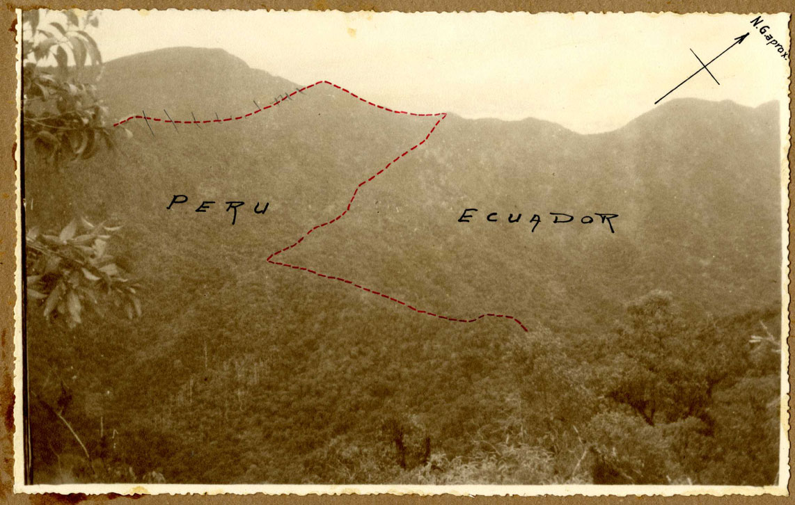
Starting with the War of ’41, until the Cenepa War of 1995, Peru and Ecuador fought for more than fifty years over the Cordillera del Cóndor. In the 1960s and 1970s, when both countries were under military dictatorships, governments sought to secure sovereignty over the disputed territory by fostering occupation through migration and colonization policies. This led to dramatic changes in the social geography of the region as indigenous territories were severely reduced; new villages, towns and roads were built; and forests were rapidly replaced by farm and pasture lands.
In the context of the neoliberal adjustments of the 1980s and 1990s, state-led projects of agricultural colonization were replaced by a different doctrine of border security that relied on corporate mining concessions as means to hold ground in the disputed territory. But until this moment, because of the decades-long military conflict, the Cordillera del Cóndor region was practically inaccessible, remaining protected from the encroachment of development projects.
The post-war peace agreements drafted in 1998 led to the creation of several reserves and parks across the border area, composing a mosaic of protected jurisdictions known as “peace parks.” Besides, vast areas on both sides of the border have been recognized as indigenous lands. Since the establishment of the Shuar Federation in the late 1960s in Ecuador, the Shuar people have mobilized to recuperate communal territories and sacred sites. Moreover, in the early 1990s Ecuador witnessed the largest indigenous uprising in its modern history, which resulted in a series of landmark territorial recognitions.
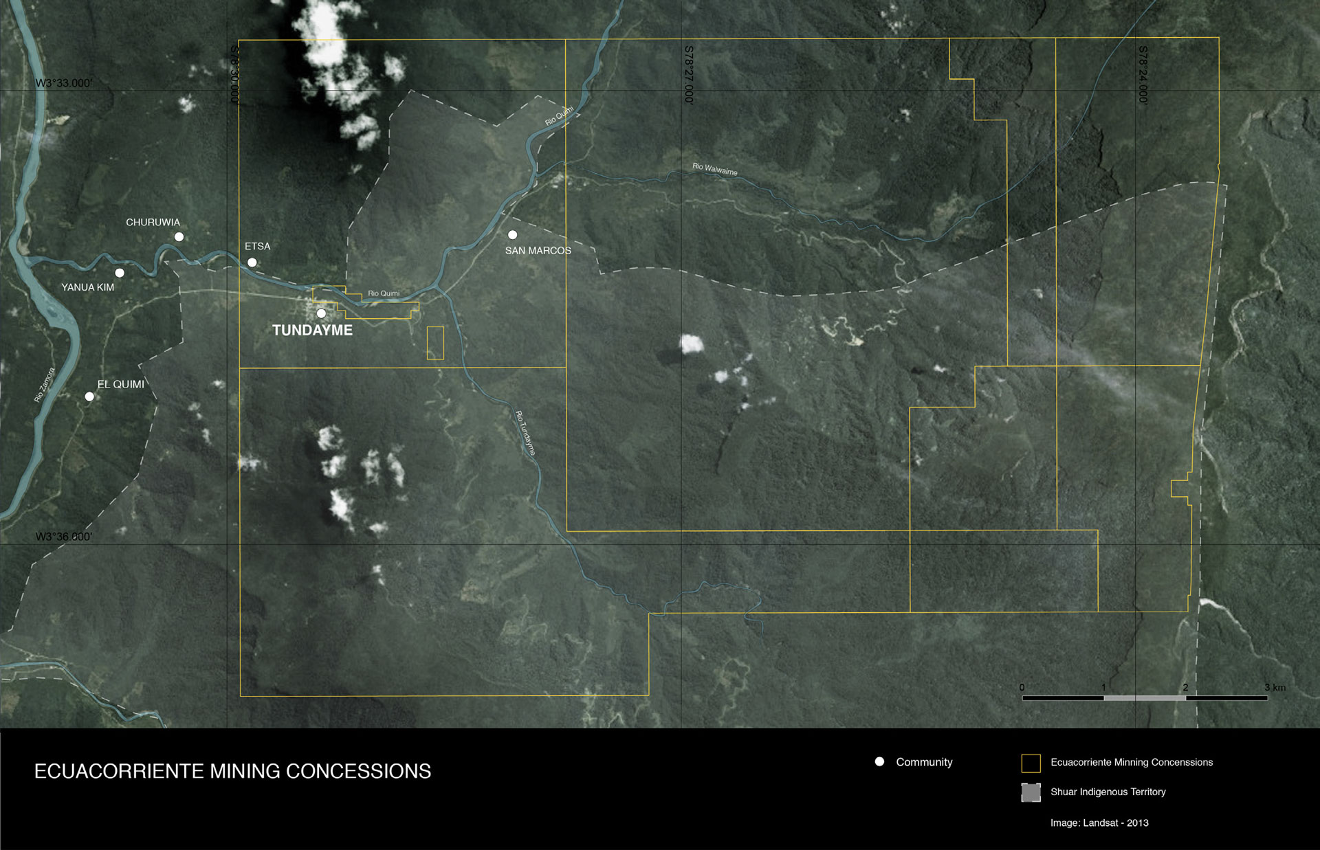
The Mirador project holds a concession of 2.994 hectares that occupies the entire area between the Tundayme and the Wawayme rivers. The Chinese–consortium led by Ecuacorriente also acquired rights to explore all other adjacent concessions to Mirador, being effectively in control of a territory larger than the urban area of the city of Barcelona. These concessions superimpose shuar territories and ecological protection areas.
Mega-mining operations like project Mirador require the exploration of vast extensions of land to be economically viable and profitable. This is only possible through massive territorial enclosures, separating entire communities from land and water resources. As the history of the Project Mirador shows, this process of enclosure is conducted by means of various strategies of deception and violence, but not without resistance.
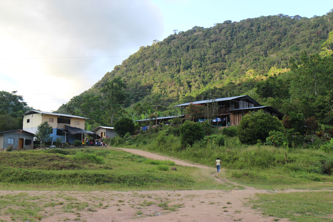
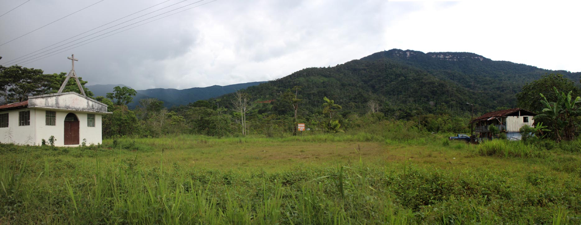
The history of San Marcos is significant because the village eventually became the epicenter of local resistance against the Mirador mega-mine. At least two families refused to leave the site, and in doing so protected the village from complete destruction, salvaging the church and the school. On 12 May 2014, without warning or judicial order, police forces and security guards of Ecuacorriente occupied the village with heavy machinery and evicted the families, razing houses, the church and the school to the ground.
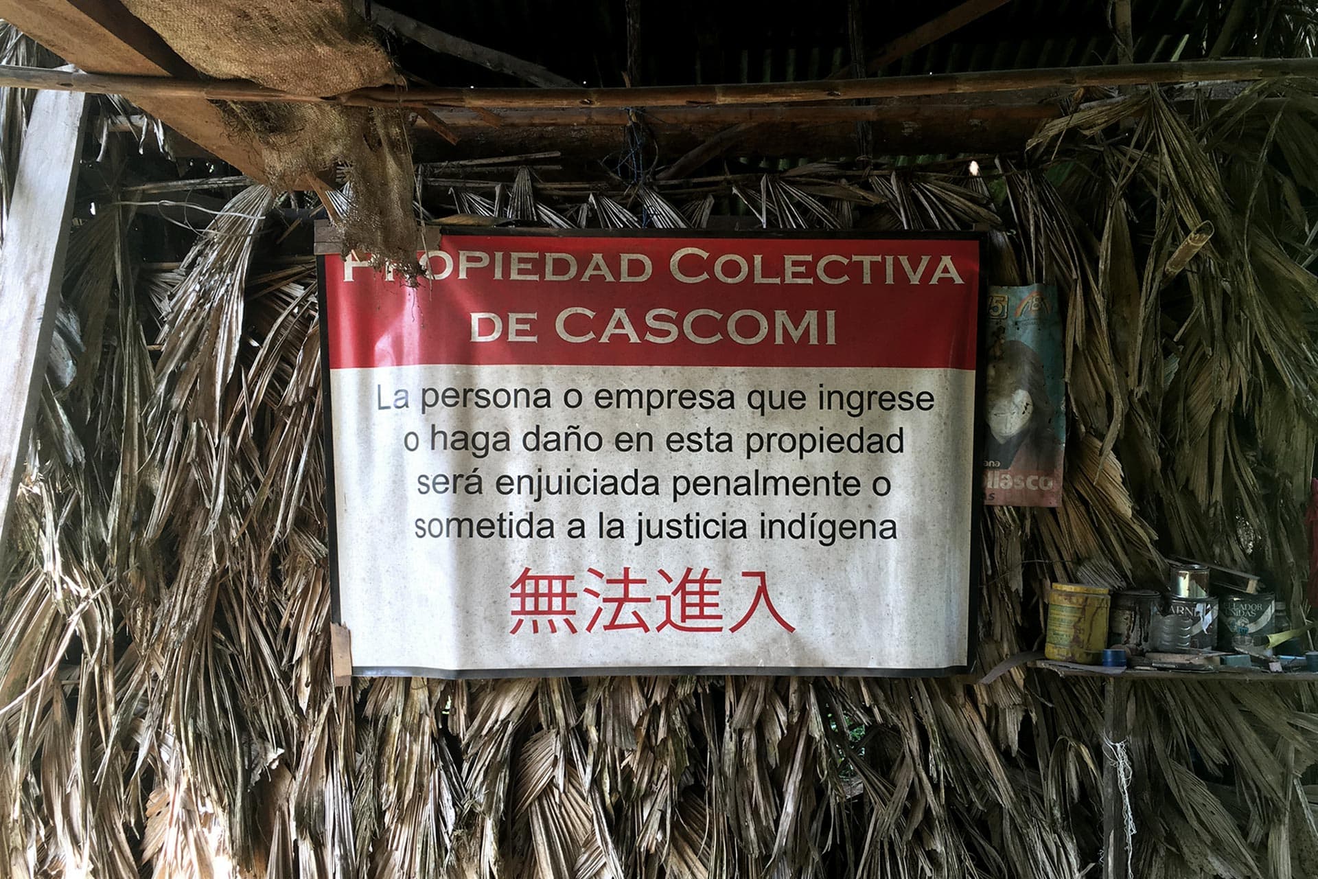
In reaction to this brutal event, some of the evicted families formed the advocacy organization CASCOMI – the Cordillera del Cóndor Amazonian Community for Social Action, initiating a series of legal measures to claim reparations. In early 2015 a farmer transferred to CASCOMI the communal property of the last plot of land in San Marcos that was not under the company’s ownership, and families started to return and built a new village center in there.
The re-occupation of San Marcos marked a turning-point in the social mobilization against the Mirador mine, and so it was not allowed to last long. Months latter, on September 2015, state forces evicted the families and the new village was destroyed.
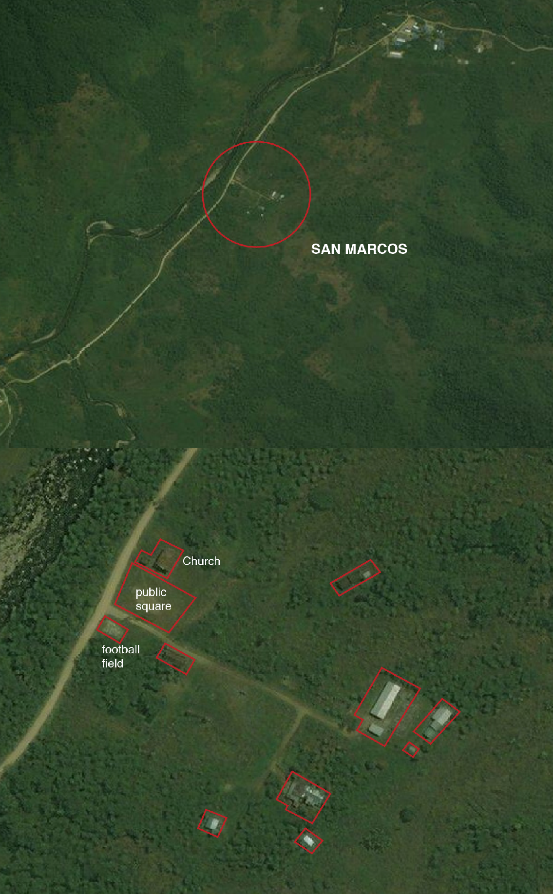
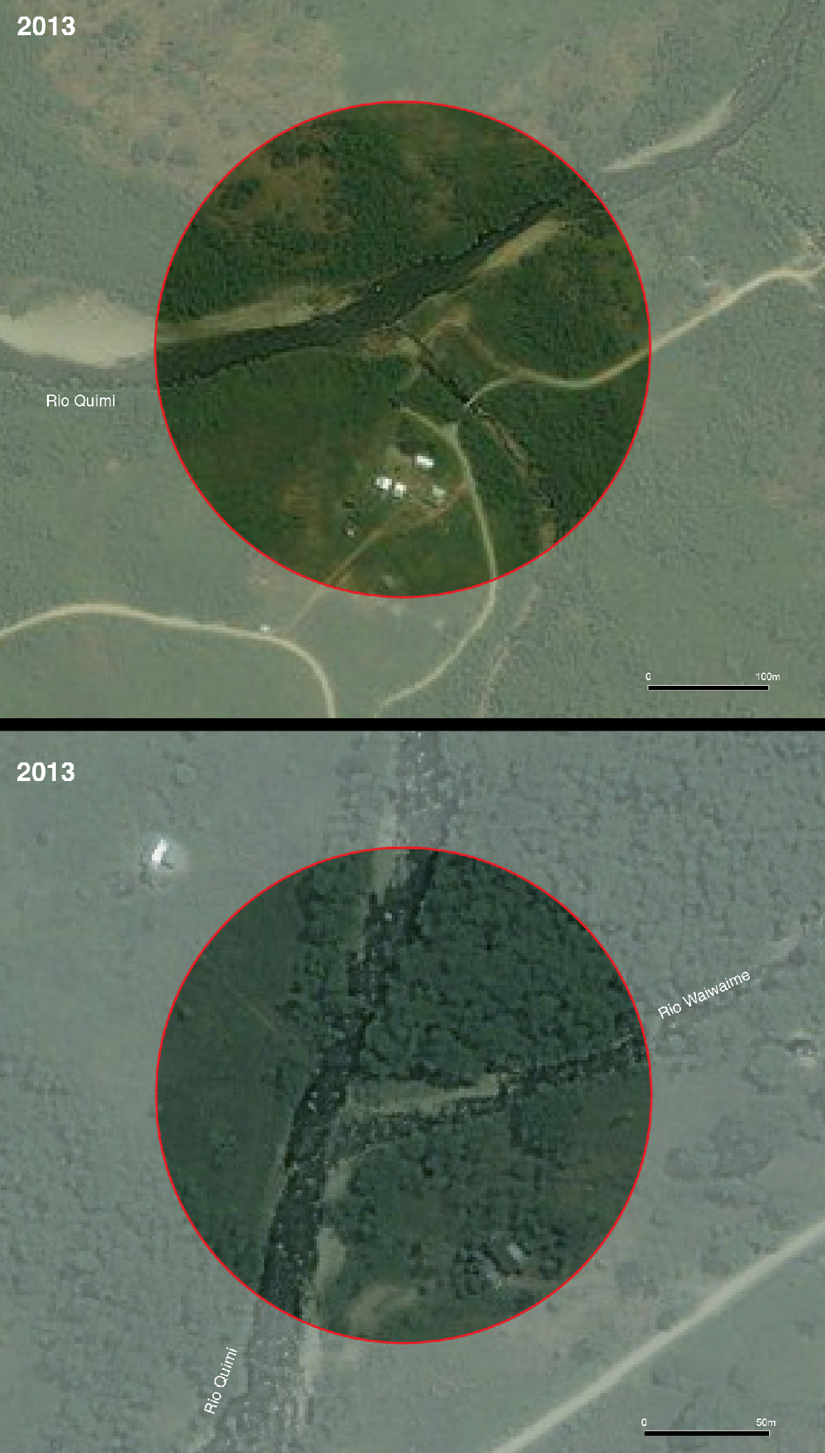
Sattelite image of the Mirador mining area in 2013, before the systematic evictions.
Location of forced evictions between 2014 and 2018 (excluding processes of "servidumbre")
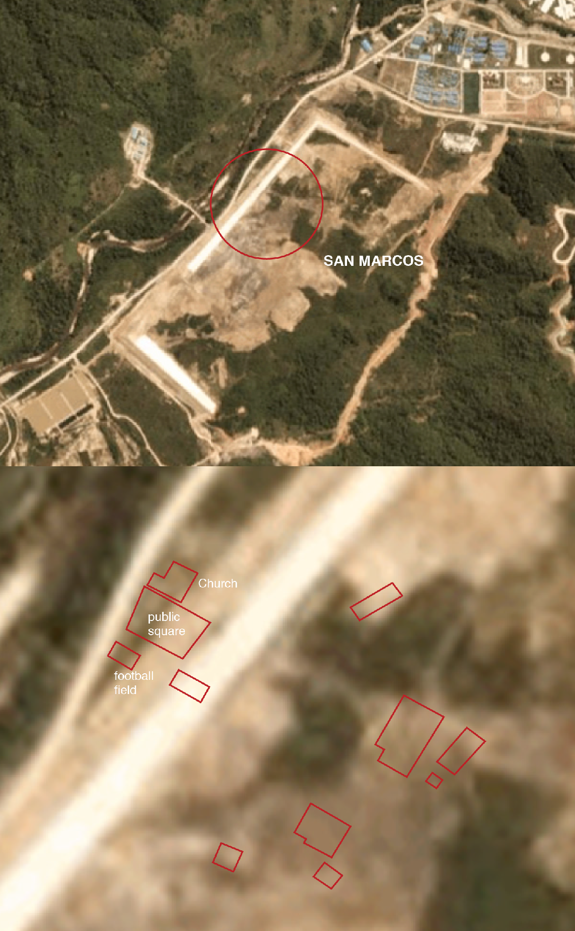
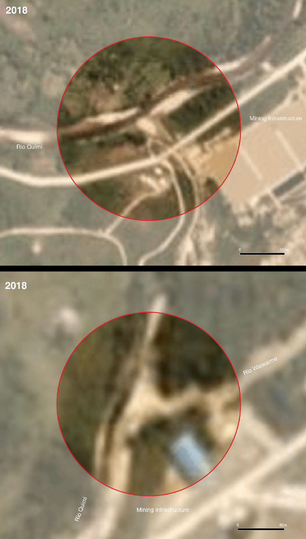
Satellite image of Mirador mining area in 2019, showing the mining pit and extraction infrastructures over location of forced displacements.
The destruction of San Marcos was the first of a series of violent evictions conducted by state and private forces between 2014 and 2017, which affected at least 27 families between shuar, kichwa and mestizos throughout the region.
On 30 September 2015, at dawn and without prior notice, police officers and security guards of the company Ecuacorriente carried out an eviction against 13 families in San Marcos and on the El Cóndor road, at the margins of the Tundayme River. Equipped with guns and bulldozers, they destroyed their homes, edible gardens and hen houses, forcing elderly, women and youth to flee without place to go.
Weeks latter, on 16 December 2015, another violent land-clearing operation was conducted across the area. Once again at dawn and without prior notice and judicial order, state and private security forces and evicted more 14 families. Similar to the displacements of September, all the houses were destroyed in front of the families as a way of terrorizing them and preventing their return.
The last evictions took place on 13 May 2016 against the shuar family Tendetza-Antún in the community of Yanua Kim, and latter on 04 February 2017 against Rosario Wari and her son, by that time the last residents of the area.
Evictions were executed according to a similar pattern in that all of them were conducted by state forces and the company's private security personnel; none of them presented judicial order; and all of them incurred in violations against the physical and psychological integrity of the community.
They were also similar in the employment of disproportional force. Evictions involved the destruction of houses in front of the families, who lost their herds, crops, working tools, domestic utensils, cash savings and other property. The rubble of the house structures, together with personal belongings that were inside them, were buried on the same plot of land. Testimonies of victims show that evictions were conducted without any plan for re-location or sheltering, leaving families in a vulnerable situation without housing.
The systematic destruction of property shows that evictions had the intent of not only removing families from the area, but also terrorizing them, thereby preventing their return and eliminating social opposition against the mine. In that sense they were not only grave human rights violations, but also instruments of political repression.
According to botanist David Neil, Cordillera del Cóndor may harbor “the richest flora of any similar-sized area anywhere... and it almost certainly has one of the highest concentrations of vascular plant species yet unknown to science of any place on Earth.” The Cordillera del Cóndor is home to various endemic species, that is, animals and plants that are native to this territory and most probably only exist here. Moreover, this region constitutes an important refuge for species in risk of extinction across the continent, including the jaguar, the spider monkey and the Andean bear.
Beginning in 2019, the mega-mine Project Mirador will be explored for 30 years, producing annual averages of 137 million pounds of cooper, 34.000 ounces of gold, and 394.000 ounces of silver. Geologically speaking, the Cordillera’s underground holds a giant mining belt, but studies also show that concentrations of metals in the regional soil are rather low. This means that for lucrative levels to be achieved, the extraction crater has to be very large and deep, processing huge quantities of earth on a daily basis. According to the plans presented by Ecuacorriente, the Mirador mine will process up to 60.000 tons of stone per day, the equivalent to 3.000 load trucks, consuming more than 200 liters of fresh water per second.
This satellite image shows the site of Project Mirador in 2013, after the destruction of the village of San Marcos and prior to the forced evictions of 2014-2017. At this moment the company Ecuacorriente was initiating the construction of the extraction complex, and few infrastructural works are visible. Most of the families alongside the Tundayme and Wawayme rivers still lived in the area.
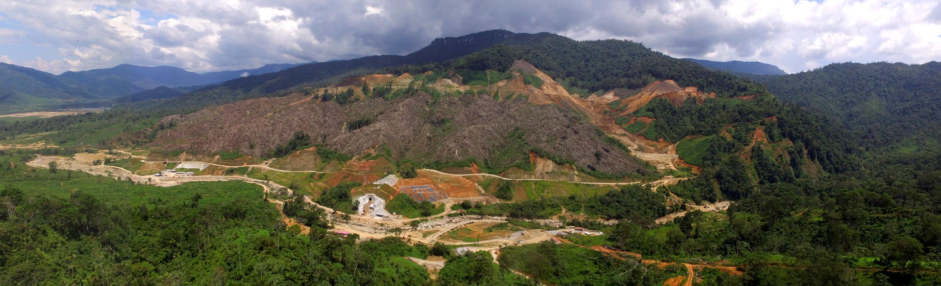
This satellite image shows the mining site in 2018, after the violent evictions of 2014-2017 that depopulated the area. The territory changed dramatically as vast tracts of forests were completely destroyed. The mine infrastructure occupies a much larger space, the tailing dams and the crater are in advanced stages of construction.
Open-pit extraction is an activity extremely harmful to the environment. Industrial scale mining operations require not only the exploration of vast tracts of land to be economically profitable, but also high consumption of water, energy and chemicals. These operations use tons of explosives and chemicals to extract metals from the soil, generating huge craters and large quantities of waste products that are highly toxic for land and rivers, and therefore also for local communities.
The waste products of mining extraction, a kind of highly-toxic mud, are stored in huge tailing dams that are much larger than the crater itself. This mud contains a series of heavy metals that can contaminate freshwater sources through various ways, such as underground infiltration, rain acidification or through direct discharges into the environment that might be necessary to contain overflows or dam collapse. Thus the scale of the Mirador infrastructure involves risk of accidents that can have devastating impacts over the entire region beyond the mining concession area.
Contamination of water streams in the Tundayme River
Mirador includes two large tailing dams. The smaller is under construction and is situated in the former site of the village of San Marcos. The second tailing pool, which has ten times the capacity, is situated above stream on the Tundayme River.
The recent catastrophic collapses of the tailing dams in Mariana and Brumadinho in Brazil, which released a deadly flow of toxic mud destroying communities and environments downstream, demonstrate the scale of the potential impact involved in mega-mining operations such as Project Mirador. Communities situated downstream the tailing pools – which include the Shuar centers of Etsa, Churubia, and Quimi; communities that live in Valle del Quimi; and the town center of Tundayme – are under threat of facing a similar devastating “disaster.” Furthermore, in a region so ecologically sensitive and important to global climate balance as Amazonia, such risk is not only local, but planetary.
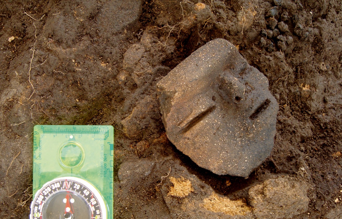
Most of the archaeological sites found in the area of Project Mirador are characterized by anthropogenic earth-movements known as terraces. Terraces are flat planes cut on a slope that were used as platforms for crop cultivation. There are at least 900 terraces in the region, all of which are associated with the occurrence of ceramic and lithic fragments, and often with impressive pottery works such as funeral urns and sculpted objects that may have had ritual functions. This indicates that in the past this region was inhabited by settled cultures that produced substantial transformations in the regional landscape and nurtured sophisticated arts and crafts.
Studies conducted as part of mining prospecting activities and environmental impact assessments demonstrate the existence of hundreds of archaeological sites distributed throughout the concession area. Given that scientific studies were not exhaustive neither systematic, but rather circumscribed to the context and interests of environmental impact assessments for mining operations, it is likely that this archaeological complex includes a much larger number of sites than already identified, extending over a much wider territory.
Several archaeological sites are located inside the mining concession area. The few sites that went through carbon tests show a concentration of dates between 800 and 1300 AD. According to one archaeological study, this allows to infer “a period of greater occupation” in this interval, just prior to the invasion of European colonizers. The communities that lived in this region were therefore the near ancestors of the Jivaroan peoples.
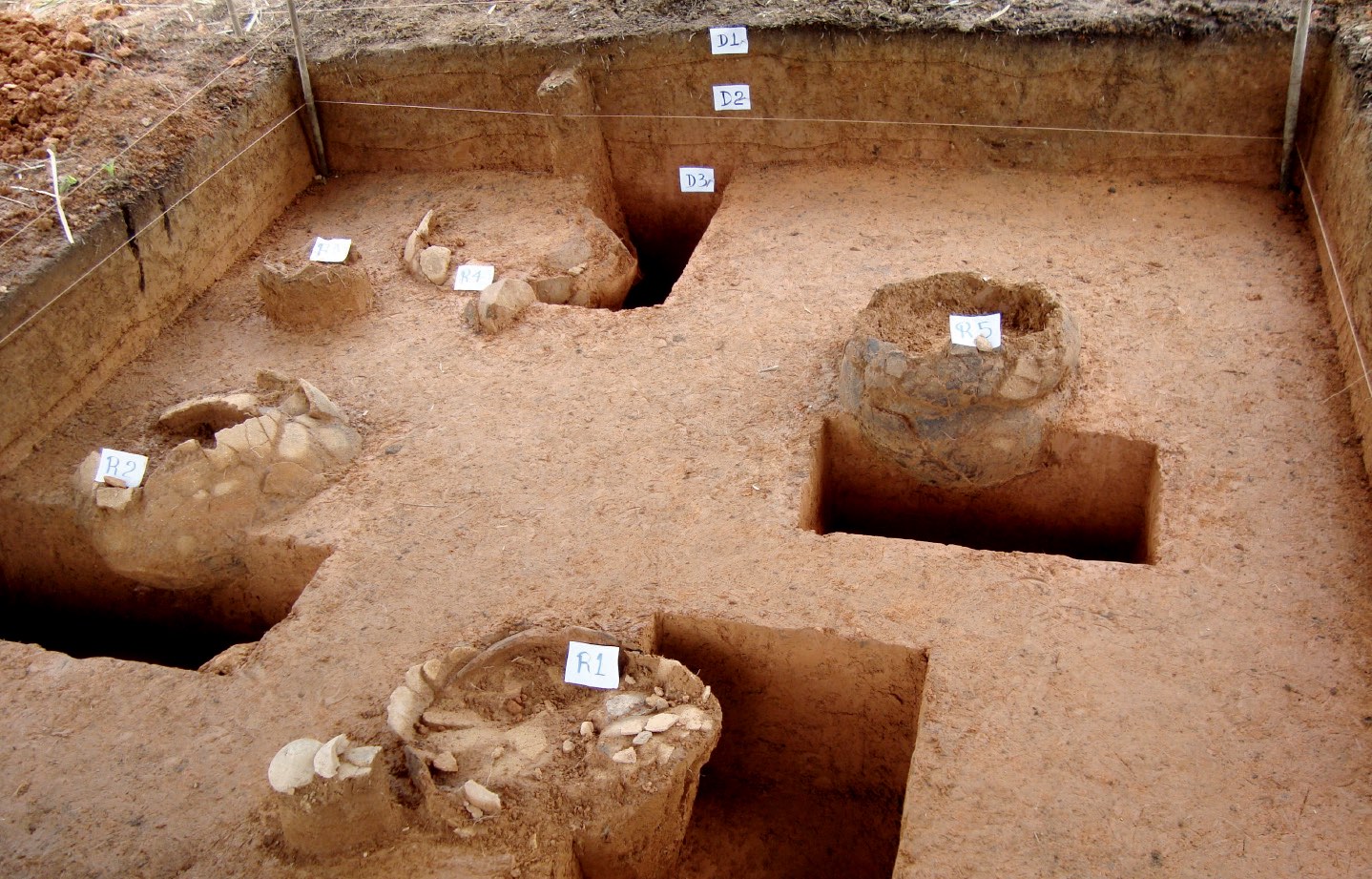
Documentation of excavation of a terrace structure st an archaeological site located where the village of San Marcos was. (site Z6DIII-04T).
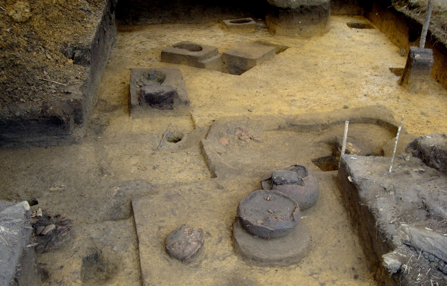
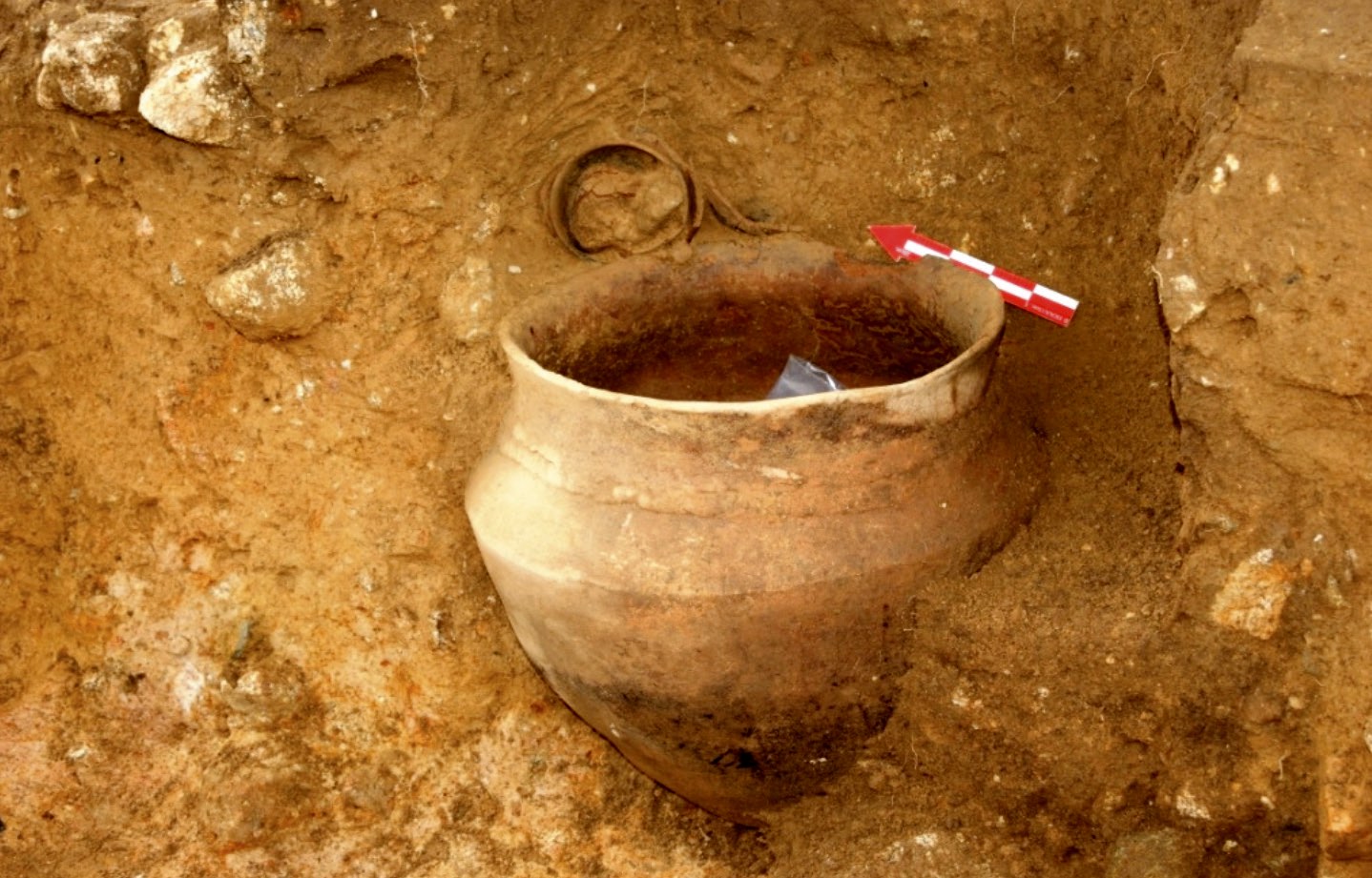
Documentation of funerary urn found during the excavation of a terraza structure in archaeological site Z6C4-010
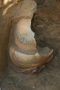
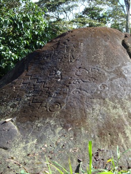
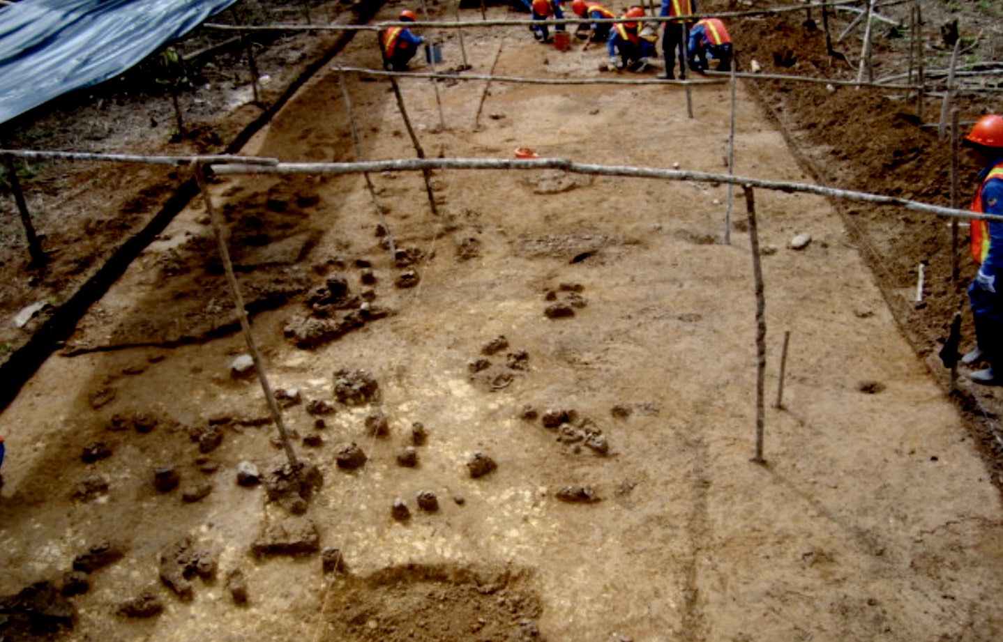
Documentation of the petroglyph found in archaeological site Z6DIII-020 before its destruction. An investigation commissioned by Ecuacorriente in 2006 identified a large petroglyph in this area. This study concludes by recommending a modification in the original project of the mine to “avoid the destruction” of the petroglyph and its adjacent archaeological structures, which included more than 30 terraced structures. These recommendations were ignored. In a field inspection conducted by the Ecuadorian National Institute of Cultural Heritage (INPC) in 2017, researchers found that the petroglyph had been “partially destroyed.”